
How to read this: Sumba Villa Investment is an independent investment-intelligence guide — we research, compare and explain Sumba land and villa opportunities, then route serious enquiries to a vetted partner. We are not a broker, developer, financial adviser, notary or law firm, and this is general information, not investment, tax or legal advice. Foreigners cannot own freehold (Hak Milik) land in Indonesia, and nominee arrangements are risky and may be unlawful — never rely on them. Figures here are indicative ranges and can change; we never promise returns. Always do your own due diligence and verify everything with a licensed Indonesian notary (PPAT) and qualified counsel before you commit.
Sumba surf zone land investment refers to the acquisition of coastal and clifftop parcels in West Sumba — principally around Kodi, Pero and the broader Wanokaka coastline — where proximity to Sumba’s best-known surf breaks drives the island’s highest asking prices. These zones sit at the intersection of genuine scarcity (a finite stretch of swell-exposed coastline), luxury-resort narrative (anchored by Nihi Sumba’s global profile), and speculative demand from buyers who believe a surf address today will become a premium development site tomorrow. That story is not entirely wrong. It is, however, far more complicated than most broker pitches acknowledge.
This piece is for buyers doing the discipline work before committing capital. It covers why the surf premium exists, what it cannot guarantee, and what the real constraints look like on the ground: coastal-setback rules whose precise distances remain locally variable and unsettled, self-provided water and power, graded-track access on most beach parcels, and an adat land system that runs parallel to — and sometimes directly against — the BPN title registry. Read this before the listing sheet, not after.
The Geography of Surf-Zone Demand in West Sumba
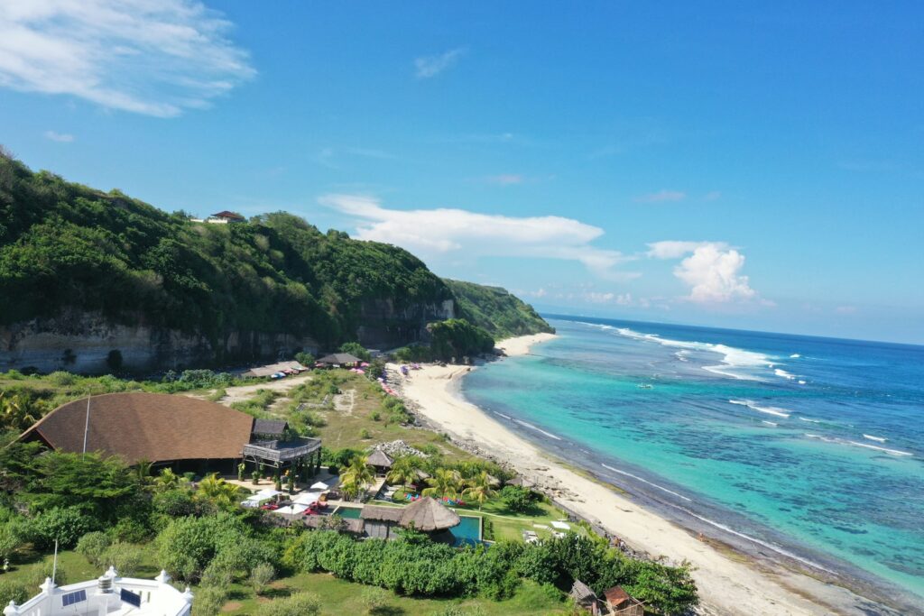
West Sumba’s surf coastline runs broadly south and southwest from the Wanokaka sub-district down through Kodi Bangedo and toward the Pero area near Kodi Utara. The orientation matters: this coast catches Indian Ocean swell that has crossed thousands of kilometres of open water, producing the powerful, consistent left-handers that made Nihiwatu famous in the first place. Pero itself — a small fishing village in Kodi Utara — sits near breaks that are known in surf-travel circles but remain far less developed than the Wanokaka zone.
Tambolaka Airport (TMC) in West Sumba is the access point for this entire corridor. It takes domestic flights from Bali (roughly one hour in the air). The overland leg from Tambolaka to the Wanokaka coast runs approximately two hours, partly on paved road and partly on tracks whose condition varies significantly between dry season (April to October) and wet. From Tambolaka to the Pero–Kodi area adds further distance along roads that are materially less maintained. That differential in access quality is a real investment variable, not a trivial inconvenience.
Why Kodi and Pero Command Attention
Kodi and Pero represent the frontier edge of West Sumba’s surf-zone land market. The Wanokaka area, by contrast, is closer to both Tambolaka and the Nihi Sumba resort, so it has absorbed most of the initial wave of demand and carries the highest asking prices in the surf corridor. Kodi pero surf land sumba listings increasingly appear in broker inventories precisely because Wanokaka supply is thinner and some buyers are moving down the coast in search of lower entry points with similar break quality.
The pattern is familiar to anyone who has watched a surf destination develop: the zone anchored by the famous resort is priced first, and demand ripples outward along the coast as early buyers price out later ones. Whether the ripple produces genuine value for Kodi and Pero — or whether it simply drags speculative asking prices upward without a comparable foundation in tourism infrastructure — is the question that current market data cannot definitively answer.
The Nihiwatu–Nihi Sumba Narrative and Its Limits
No discussion of surf break land value in Sumba is complete without a frank assessment of what the Nihi Sumba effect actually is and is not. The resort was founded in 1988 by Claude and Petra Graves on the Wanokaka coast, built around a near-perfect left-hand break that the couple treated as a private resource — surf access was rationed as part of the resort’s exclusivity model. In 2012, the property was acquired by Christopher (Chris) Burch and James McBride and subsequently rebranded as Nihi Sumba. The current footprint is approximately 567 acres, with around 27 villas and 38 rooms (sources vary; one cites 33 villas).
Nihi Sumba has appeared repeatedly on international rankings of the world’s best hotels and resorts. That is a verifiable fact. The informal nightly rate figure circulating in land-broker pitches is in the range of USD 1,000–2,000+ per villa, but this guide treats that as an unverified estimate — not a rate card. What the resort has unambiguously done is create a geographic mental category for West Sumba that did not previously exist in global luxury travel and property markets. Awareness, which is real, is then leveraged into land listings that use Nihi proximity as the primary value anchor.
The discipline buyers need here is to separate the awareness effect from actual market mechanics. West Sumba surf property asking prices in the Wanokaka–Kodi corridor sit in a range consistent with broader West Sumba beachfront data: current verified listings indicate approximately IDR 22–24 million per are (100 m²) for oceanfront parcels, with some broker marketing framing hectare prices from around USD 95,000. These figures are asking prices from listings, not transaction-cleared data. Indonesia has no public land-transaction registry — no price is confirmable until a deed is signed, registered, and cross-referenced against an actual closing, and none of that is publicly available in this market.
Broker claims in wider circulation — land values up “1,200%,” demand growing “30% annually,” rental yields of “18–20% ROI” — appear on agency websites but carry no independent transaction evidence. This guide does not repeat them as fact. Phrase them, always, as attributed marketing claims from named sellers, and apply the scepticism any figure deserves when the source profits from the transaction.
What Surf Proximity Does and Does Not Deliver
The sentiment driver behind west sumba surf property premiums is understandable: surf breaks are geographically fixed, and a good break with a resort pedigree creates a story that sells. But surf proximity is not infrastructure, and it is not income. Three distinctions matter.
Surf Access vs. Guest Demand
A parcel with a view of a break — or even direct beach access — does not automatically attract guests willing to pay premium nightly rates. Sumba’s overall tourism volume is much smaller and earlier-stage than Bali’s or even Lombok’s. The real demand for surf accommodation in West Sumba is, in practical terms, concentrated at and immediately around Nihi Sumba. Outside that specific resort, the market for standalone surf-facing villas is thin, with no publicly available occupancy or yield data to anchor projections. A boutique surf lodge on a Kodi cliffside is a viable concept in theory; its path to stable occupancy involves challenges — routing guests to Tambolaka, overland transfers, marketing against an established resort — that a listing price does not price in.
Scarcity vs. Liquidity
Surf-exposed coastline in Sumba is genuinely scarce. That scarcity justifies a premium over inland agricultural land, all else equal. What scarcity does not create is liquidity. The pool of buyers who will take an assignment of your 25-year leasehold in year eight is small. Lenders do not write mortgages against Sumba leasehold land. The secondary market for surf-zone parcels in this corridor is, at present, a small number of specialist agents and an even smaller number of serious buyers. Exit assumptions need to be modelled honestly: long hold, uncertain clearing price, limited comparable transactions.
Halo Premium vs. Build Feasibility
Asking prices in the Nihi corridor often reflect the resort’s proximity without reflecting the cost of making the specific parcel buildable. Remote coastal Sumba land typically requires self-constructed road access, off-grid power (solar hybrid systems — PLN grid reliability on remote coastal parcels is not dependable), borehole water supply, and wastewater treatment. Construction costs on remote Sumba sites are not published in any reliable survey; as an orientation only, Bali mid-market reinforced-concrete villa construction runs practitioners roughly USD 600–1,000 per square metre, and remote Sumba sites tend to run higher once logistics, materials transport, and the shallow local tradesperson supply chain are factored in. Budget a contingency of at least 20–30% over any headline rate, and commission a site-specific bill of quantities from an independent quantity surveyor before money moves.
| Factor | What the listing says | What to verify independently |
|---|---|---|
| Price per are | IDR 22–24m/are (oceanfront, indicative asking price) | No public transaction database — treat all figures as indicative asking prices only |
| Surf proximity | “Near Nihi” / “surf break access” | Actual distance, break orientation, paddling access vs. shore break |
| Road access | Often omitted or described as “accessible” | Surface type, dry vs. wet-season passability, who maintains the track |
| Power & water | Rarely specified | PLN connection status; bore depth, yield and quality for groundwater |
| Coastal setback | Sometimes cited as 100m / 30m / 10m (single developer source) | Confirm buildable envelope with Dinas PUPR, Bappeda and local BPN — the exact distance is locally determined and not confirmed by any single verified source |
| Title type | SHM or “certificate” asserted | In-person BPN check; full chain of title; boundary survey |
| Adat status | Rarely mentioned | Kabisu clan consultation, village-head consent, customary-use history |
| Zoning (RTRW) | Usually not disclosed | Regency spatial plan; LP2B protected-agricultural designation; coastal zone classification |
Coastal-Setback Rules: The Number Nobody Can Give You
Coastal setback — the minimum distance between a permanent structure and the high-water mark — is one of the most practically important variables for any beachfront or clifftop parcel, and it is also one of the least settled in Sumba. Indonesia applies coastal setback rules under national frameworks, but the exact metre distance is set provincially and locally and varies between jurisdictions. A developer FAQ circulating in broker materials claims Sumba applies a 100-metre setback for permanent concrete structures, with reduced distances in certain scenarios. That figure comes from a single, unnamed developer source and has not been confirmed in law or regulation.
Do not build a project feasibility on an unverified metre figure. The correct verification path is: Dinas Pekerjaan Umum dan Penataan Ruang (PUPR) at the regency level, the Bappeda spatial planning office, and the local BPN office. Those agencies hold the current RTRW and coastal-zone regulations that govern what can be built, how close, and in what form. Some coastal parcels in West Sumba that are marketed as buildable beachfront sit partly or entirely within the restricted setback zone — this is not disclosed on the listing.
One further point: coastal land in Indonesia carries an additional classification layer — the kawasan sempadan pantai (coastal buffer zone) — under which certain uses are restricted regardless of RTRW zoning. Confirm both layers with licensed professionals and local authorities before assuming any coastal parcel is fully buildable.
Adat Land Risk in the Surf Zone: Acute, Not Residual
The customary land dimension of surf-zone investment in West Sumba is not a background risk. It is acute, and it is highest precisely where coastal land is most commercially attractive.
West Sumba’s social structure organises around kabisu — patrilineal clans whose identity, ritual life, and land relationships are governed by Marapu tradition. In many coastal communities, beach land and adjacent areas carry ancestral significance that predates any BPN certificate by generations. Clan members may not have formalised their claim through the state registry, but the community recognises the claim as binding. When an investor buys a certificate without going through community consultation, the transaction may be legally valid under the national land-law framework and simultaneously contested by the kabisu — because two different systems of authority are in play.
The Marosi Beach area in West Sumba is one documented context for this tension: reported conflicts between investor-side interests and local adat-land communities have appeared in Indonesian media and land-rights monitoring literature (“sengketa tanah Pantai Marosi Sumba Barat” is the search term for those who want primary sources). The guide cites this as a category of risk, not as an allegation against any named party. The pattern it illustrates is real: coastal West Sumba beach land, including surf-zone areas around Kodi and Pero, carries community-land risk that a BPN certificate alone does not resolve.
What adat due diligence actually involves in practice:
- Identifying which kabisu has customary authority over the specific parcel — this requires engagement with village leadership, not just the individual seller
- Confirming that the original transfer into private title had documented kabisu consent, not just a village-head signature that may or may not represent the full clan
- Establishing whether the parcel has ongoing ritual significance — certain coastal sites, particularly near traditional fishing grounds, carry obligations that affect what can be built and when
- Understanding whether there are any pending community claims, formal or informal, before you sign anything
A notary and PPAT can execute a legally valid deed and still leave you with a dispute. The legal framework and the social reality in coastal West Sumba are not always the same thing. Adat validation should sit beside the BPN registry check — not after it.
If you want guidance on how to structure community due diligence alongside standard title verification for a specific surf-zone parcel, use our enquiry form or reach us on WhatsApp at 6281139414563. We can connect you with specialists who work in this specific region.
Discounting Asking Prices: A Framework
The practical question for any buyer looking at kodi pero surf land sumba or the wider Wanokaka corridor is: how much should I discount the asking price? There is no formula, but there are rational adjustments to work through.
Start with the infrastructure gap. If the parcel requires a graded-track road (budget IDR 300–600 million or more per kilometre depending on terrain, as a rough orientation — get a contractor quote), off-grid power (solar hybrid systems for a mid-sized villa run anywhere from IDR 200 million upward), and a water bore and treatment system (variable, site-dependent), those costs come off the top of any budget before a foundation is poured. A listing price that ignores infrastructure is inflated relative to a comparable parcel that already has road, power and water.
Then apply a liquidity discount. Sumba leasehold land is significantly less liquid than Bali leasehold; exit timelines should be measured in years, not months, and there is no guarantee of finding a buyer at the asking price. A rational buyer in an illiquid frontier market prices in that risk.
Then apply a title-and-adat contingency. If the due diligence process reveals any adat complexity, contested boundaries, or chain-of-title gaps, those are costs — potentially large ones — that the listing price does not reflect. The absence of information is not a green light; it is a call for deeper work before any commitment.
What Access Really Means for Kodi and Pero
The access gap between Wanokaka and Kodi–Pero is not trivial. Guests arriving at Tambolaka face a longer, rougher transfer to the Pero area than to the Wanokaka–Nihi corridor. In the wet season — roughly November to March — some tracks in the Kodi sub-district become difficult to navigate without four-wheel drive. A surf lodge or villa that cannot reliably collect guests from the airport in under three hours has a real operational problem, not a romantic inconvenience.
Road investment in West Sumba has improved some routes, and further infrastructure development is part of the provincial planning picture. But improvements are uneven, specific project timelines are not publicly confirmed, and access conditions at the point of a specific parcel need to be assessed on the ground — not inferred from general statements about West Sumba development. Commission a dry-season and wet-season site visit before buying.
Before You Commit: The Non-Negotiable Checklist
This is general information, not investment advice, and no outcome — rental yield, appreciation, approval, or development success — is promised or implied. Every surf-zone parcel is different, and professional verification is not optional.
- Title verification
- In-person check at the local BPN office: authenticate the certificate, confirm chain of title, check for encumbrances, commission an independent boundary survey. Never rely solely on copies provided by the seller or broker.
- Zoning and setback
- Obtain the current RTRW and coastal-zone classification from Dinas PUPR, Bappeda and BPN. Establish the actual buildable envelope on the parcel before any feasibility work. Do not accept an unverified metre figure for the setback.
- Adat due diligence
- Engage a local facilitator or land-rights practitioner with knowledge of West Sumba customary structures. Identify the relevant kabisu, confirm historical consent at the point of original privatisation, check for any pending community claims. This runs in parallel with BPN verification, not after it.
- Infrastructure scoping
- Get actual contractor quotes for road access, power, water and wastewater at the specific site. Add a minimum 20–30% contingency. Do not work from general per-square-metre norms; remote Sumba site logistics are a separate cost category.
- Legal structure
- Confirm your ownership pathway with a licensed Indonesian notary, PPAT and independent legal counsel — not the broker’s recommended notary. Foreigners cannot hold Hak Milik under any circumstances. The practical routes are leasehold (Hak Sewa), Hak Pakai with a valid residency permit, or a correctly structured PT PMA holding HGB. Each carries different legal implications, costs and risk profiles.
- Exit modelling
- Before buying, understand how you would sell. Who are the likely buyers in five, ten, fifteen years? What will a lease assignment require? What happens to your position if the kabisu or a successor government raises a land claim during the hold period? Model the illiquidity explicitly.
For routing toward licensed professionals — notary, PPAT, independent legal counsel, and community-due-diligence specialists in West Sumba — reach us via our enquiry form or on WhatsApp at 6281139414563. We do not sell land; if you use our referral network and proceed with a partner, that partner may pay us a referral fee at no extra cost to you.
Frequently Asked Questions
Why does surf-zone land in Kodi and Pero carry a premium over other West Sumba coastal land?
The premium reflects a combination of genuine coastal scarcity — Indian Ocean swell exposure is geographically fixed — and the narrative halo from Nihi Sumba, which put West Sumba on the global luxury-travel map and concentrated broker and buyer attention on the southwestern coast. Pero and Kodi also offer break quality comparable to the more developed Wanokaka corridor at lower entry prices, which attracts buyers priced out of the Nihi-adjacent zone. The premium is real at the asking-price level; whether it translates to realised value on exit depends on factors — liquidity, tourism infrastructure maturation, adat resolution — that current data cannot confirm.
What are the coastal setback rules for building on beachfront land in West Sumba?
Indonesia applies coastal setback rules under national frameworks, but the exact distance is set provincially and locally and varies by jurisdiction. A figure of 100 metres for permanent concrete structures has been cited by a single developer source in broker-circulated material, but this has not been confirmed in any publicly verifiable regulation. Buyers should obtain the current setback distance and coastal-zone classification directly from Dinas PUPR, Bappeda, and the local BPN office for the specific regency and sub-district. Do not build a feasibility model on an unverified figure from a seller or broker.
What is adat land risk, and how does it affect surf-zone parcels specifically?
Adat (customary) land risk arises from the parallel authority of the kabisu (clan) system in West Sumba, which predates and in some cases conflicts with the national BPN title registry. Coastal and beachfront land — precisely the areas that carry surf-zone premiums — tends to have higher adat sensitivity because of ancestral fishing rights, ritual site obligations, and the historical significance of the coast to clan identity. A BPN certificate is a state-law document; it does not automatically extinguish community recognition of prior customary claims. Disputes in documented West Sumba coastal areas (Marosi Beach is a cited example) illustrate what happens when the two systems collide. Adat due diligence through a local specialist should be conducted before any deposit is paid, not treated as a formality after the title check.
Is there rental demand for surf villas in Kodi and Pero?
There is no publicly available occupancy or yield data for standalone surf villas in the Kodi–Pero area. Sumba’s tourism volume overall is much smaller and earlier-stage than Bali’s, and real demand is concentrated at and immediately around established resorts, principally Nihi Sumba in Wanokaka. A surf-facing villa in Kodi or Pero would compete against that established infrastructure while bearing higher transfer costs for guests. Rental-demand projections for this area are speculative; any yield figure from a broker or developer should be treated as a projection, not a forecast backed by market data. No rental income, occupancy rate, or return on investment is promised or implied by this guide.
How do I verify a land certificate for a surf-zone parcel in West Sumba before buying?
Title verification requires an in-person visit to the local BPN (Badan Pertanahan Nasional) office, where you can authenticate the certificate number, check the land book for encumbrances, and confirm ownership history. This should be done by or with a licensed Indonesian notary or PPAT — not the one recommended by the seller, to avoid a conflict of interest. Independently commission a boundary survey to confirm the physical parcel matches the certificate. Then run the zoning check (RTRW) and adat consultation in parallel. The combination of all four steps — title, boundary, zoning, adat — constitutes a minimum due diligence for any West Sumba coastal parcel; none of them can be skipped without materially increasing your risk exposure.